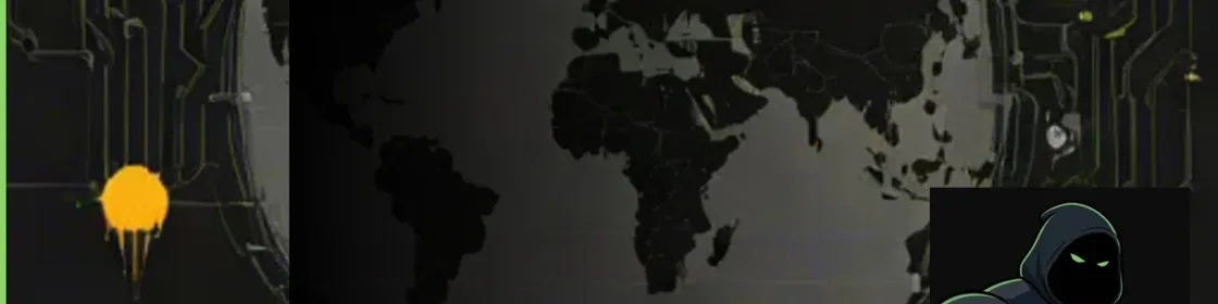
WorldView ทำอะไรจริงๆ
WorldView โดย kevtoe คือแพลตฟอร์ม tactical intelligence แบบ open source ฟรีที่ replicate ฟังก์ชันหลักของ Gotham และ Foundry ของ Palantir: รวมแหล่งข้อมูล real-time ที่หลากหลายเป็นภาพปฏิบัติการเดียว รันบน CesiumJS globe 3D และติดตามเครื่องบินสด 27,000+ ลำ ดาวเทียมวงโคจร เรือทั่วโลก แผ่นดินไห และ CCTV สด — พร้อมกัน ที่ 60 fps GitHub repo อยู่ที่ github.com/kevtoe/worldview มี demo สดที่ worldview.kt-o.com
ทำไมเรื่องนี้สำคัญต่อ founder และ builder?
Palantir เรียกเก็บจากรัฐบาลสหรัฐหลายร้อยล้านดอลลาร์สำหรับสิ่งนี้โดยประมาณ: ระบบดึง feed ข่าวกรองจากแหล่งต่างๆ normalize และ render บน geospatial interface ให้ operator ลงมือ WorldView พิสูจน์ว่า architecture ด้านล่างไม่ใช่ proprietary — เป็นปัญหาซอฟต์แวร์ และซอฟต์แวร์นั้นฟรีแล้ว moat ทางการค้าไม่เคยเป็นเทคโนโลยี แต่เป็นสัญญารัฐและการเข้าถึงข้อมูล สิ่งที่ kevtoe build ใน repo เดียวเคย cost defense contractor หลักสิบล้านเมื่อ decade ก่อน
WorldView รวมแหล่งข้อมูลอะไรบ้าง?
แต่ละ layer ดึงจาก public API หรือ data standard ต่างกัน — นี่คือส่วนที่ยากที่ Palantir สร้างบริษัทมาแก้ และ WorldView ทำฟรี:
- เที่ยวบิน: FlightRadar24 และ adsb.fi รวม coverage — เครื่องบิน 27,000+ ทั่วโลก
- ดาวเทียม: ข้อมูลวงโคจร TLE พร้อม SGP4/SDP4 propagation ผ่าน satellite.js — คำนวณตำแหน่งฝั่ง client
- เรือ: AISStream.io WebSocket — 2,000–4,000 ลำต่อ burst 20 วินาที cache 60 วินาที
- แผ่นดินไห: USGS API — กิจกรรมแผ่นดินไห 24 ชั่วโมงที่ผ่านมาทั่วโลก
- เครือข่ายถนน: OpenStreetMap Overpass API
- CCTV: กล้องสาธารณะสดจาก London, Austin และ Sydney
WorldView จัดการ 27,000 entity ที่ 60 fps อย่างไร?
ตรงนี้ engineering น่าสนใจ React render component 27,000 ตัวใช้ไม่ได้ WorldView bypass reconciler ของ React สำหรับ entity rendering — ใช้ Cesium primitive แบบ imperative โดยตรง อัปเดตตำแหน่งโดยไม่แตะ component tree ตำแหน่งเครื่องบิน dead-reckoned ระหว่างรอบ API update: velocity และ heading ล่าสุด extrapolate ตำแหน่งปัจจุบันที่ frame rate ผลคือการเคลื่อนไหว 60 fps ลื่นแม้ข้อมูล refresh ทุก 10–30 วินาที
รูปแบบ AIS burst
การติดตามเรือใช้ burst-and-cache โดยเจตนา: เชื่อม AISStream.io 20 วินาที เก็บตำแหน่งเรือ 2,000–4,000 ลำ ตัดการเชื่อม cache 60 วินาที ทำซ้ำ pattern นี้แก้ปัญหา serverless timeout — WebSocket คงที่จะเกิน limit ของ Vercel function pattern แลกความ stale เล็กน้อยกับ deployment ง่าย ซึ่งเป็น trade ที่ถูกสำหรับเครื่องมือที่คนเดียว build
WorldView เทียบ Palantir Gotham อย่างไร?
| ฟีเจอร์ | WorldView (kevtoe) | Palantir Gotham |
|---|---|---|
| Globe geospatial 3D | CesiumJS (open source) | Custom / Cesium-based |
| ติดตามเที่ยวบิน real-time | เครื่องบิน 27,000+ ผ่าน public API | Feed รัฐบาล/ทหาร |
| ติดตามดาวเทียม | SGP4 orbital propagation | TLE ลับและเชิงพาณิชย์ |
| ติดตามเรือ AIS | AISStream.io (public) | Feed หน่วยงานทางทะเล |
| Post-processing effects | GLSL: night-vision, thermal, CRT | Visualization proprietary |
| Deployment | Vercel, self-host ได้, ฟรี | On-prem / classified cloud |
| ค่าใช้จ่าย | $0 (open source) | สัญญารัฐ $100M+ |
WorldView ใช้ tech stack อะไร?
Frontend คือ React 19 + TypeScript 5.9 กับ CesiumJS 1.138 ผ่าน Resium, Tailwind CSS v4 และ Vite 7 Backend คือ Express 5 พร้อม node-cache สำหรับ cache API response และ WebSocket สำหรับ AIS stream GLSL shader จัดการ post-processing: CRT scanlines, night-vision ฟอสฟอร์เขียว และ FLIR thermal imaging ทั้งหมด deploy ไป Vercel เป็น full-stack application API key ที่ต้องใช้: Google Maps 3D tiles, Cesium Ion, Transport NSW สำหรับ traffic Sydney และ AISStream.io สำหรับเรือ ทุก layer degrade gracefully โดยไม่มี credential
self-host WorldView ได้ไหม?
ได้ repo ใช้ MIT license และ deploy ได้บน host ที่รัน Node ได้ Vercel เป็น path zero-config — โครงสร้างโปรเจกต์ wire ไว้แล้ว ต้องตั้ง environment variable สำหรับแต่ละ API key ทุก layer เป็น optional globe render ได้แค่ CesiumJS ion credential แล้วเพิ่ม data layer ตาม config แต่ละ API source instance self-host คือค่า hosting plan — free tier ของ Vercel รับ traffic เบาได้
ที่เกี่ยวข้อง: วิธีที่ผมใช้ Claude Code เป็นเครื่องมือ AEO และ SEO
สรุป
WorldView เป็นหนึ่งในโปรเจกต์ GitHub solo ที่น่าประทับใจทางเทคนิคที่สุดที่เคยเห็น ไม่ใช่ของเล่น — เป็น geospatial intelligence dashboard จริงที่แก้ปัญหา engineering จริง: multi-source data fusion, rendering entity จำนวนมากที่ frame rate, graceful degradation และ deployment พร้อม production การเทียบ Palantir ไม่ใช่ hyperbole value proposition หลักของ defense contractor มูลค่าพันล้านคือ: เราสร้างซอฟต์แวร์รวม feed ข่าวกรองของคุณได้ ซอฟต์แวร์นั้นอยู่บน GitHub ฟรีแล้ว สิ่งที่ Palantir ขายคือสัญญา compliance posture และการเข้าถึงข้อมูลลับ — ไม่ใช่โค้ด
คำถามที่พบบ่อย
WorldView โดย kevtoe คืออะไร?
WorldView คือ tactical intelligence dashboard real-time แบบ open source ฟรี สร้างโดย developer ชื่อ kevtoe และเผยแพร่บน GitHub แสดงเที่ยวบิน ดาวเทียม เรือ แผ่นดินไห traffic และ CCTV สดบน CesiumJS globe 3D interactive ใช้งานได้ในระดับแนวคิดเดียวกับ geospatial intelligence interface ที่บริษัทอย่าง Palantir สร้าง โดยใช้ public API และ library open source ทั้งหมด
WorldView เทียบ Palantir ได้จริงไหม?
สำหรับ use case geospatial tracking และ data fusion หลัก ใช่ WorldView ทำในภาพรวมสิ่งที่ Gotham ของ Palantir ทำ: รวมแหล่งข้อมูล real-time ที่หลากหลายเป็นภาพปฏิบัติการเดียวบน globe 3D ข้อได้เปรียบเชิงพาณิชย์ของ Palantir อยู่ที่การเข้าถึงข้อมูลลับ ใบรับรอง compliance รัฐบาล และสัญญาระยะยาว — ไม่ใช่ software architecture ด้านล่าง
รัน WorldView เองอย่างไร?
Clone repo จาก github.com/kevtoe/worldview เพิ่ม API key ใน environment variable (Cesium Ion เป็นขั้นต่ำ) และ deploy ไป Vercel หรือ Node host ใดก็ได้ แต่ละ data layer — เที่ยวบิน เรือ ดาวเทียม แผ่นดินไห — config แยกได้และ degrade gracefully ถ้าไม่มี API key นั้น
WorldView ใช้ API อะไรบ้าง?
WorldView integrate FlightRadar24 และ adsb.fi สำหรับข้อมูลเที่ยวบิน แหล่ง TLE สำหรับข้อมูลวงโคจรดาวเทียม AISStream.io สำหรับติดตามเรือ USGS API สำหรับแผ่นดินไห OpenStreetMap Overpass API สำหรับเครือข่ายถนน และ CCTV สาธารณะจาก London, Austin และ Sydney Google Maps 3D tiles และ Cesium Ion จัดการ globe rendering ฐาน
อะไรทำให้ rendering ของ WorldView เร็ว?
WorldView bypass component reconciler ของ React สำหรับ entity rendering ใช้ CesiumJS primitive แบบ imperative โดยตรง ตำแหน่งเครื่องบินและเรือ dead-reckoned ระหว่าง API update — velocity และ heading extrapolate ตำแหน่งปัจจุบันที่ 60 fps ให้การเคลื่อนไหวลื่นแม้ข้อมูล refresh ทุก 10–30 วินาที
โพสต์นี้เป็น technical review ของโปรเจกต์ GitHub open source ไม่มีความเกี่ยวข้องกับ kevtoe หรือ Palantir Technologies
Frequently Asked Questions
WorldView โดย kevtoe คืออะไร?
WorldView คือ tactical intelligence dashboard real-time แบบ open source ฟรี สร้างโดย developer ชื่อ kevtoe และเผยแพร่บน GitHub แสดงเที่ยวบิน ดาวเทียม เรือ แผ่นดินไห traffic และ CCTV สดบน CesiumJS globe 3D interactive ใช้งานได้ในระดับแนวคิดเดียวกับ geospatial intelligence interface ที่บริษัทอย่าง Palantir สร้าง โดยใช้ public API และ library open source ทั้งหมด
WorldView เทียบ Palantir ได้จริงไหม?
สำหรับ use case geospatial tracking และ data fusion หลัก ใช่ WorldView ทำในภาพรวมสิ่งที่ Gotham ของ Palantir ทำ: รวมแหล่งข้อมูล real-time ที่หลากหลายเป็นภาพปฏิบัติการเดียวบน globe 3D ข้อได้เปรียบเชิงพาณิชย์ของ Palantir อยู่ที่การเข้าถึงข้อมูลลับ ใบรับรอง compliance รัฐบาล และสัญญาระยะยาว — ไม่ใช่ software architecture ด้านล่าง
รัน WorldView เองอย่างไร?
Clone repo จาก github.com/kevtoe/worldview เพิ่ม API key ใน environment variable (Cesium Ion เป็นขั้นต่ำ) และ deploy ไป Vercel หรือ Node host ใดก็ได้ แต่ละ data layer — เที่ยวบิน เรือ ดาวเทียม แผ่นดินไห — config แยกได้และ degrade gracefully ถ้าไม่มี API key นั้น
WorldView ใช้ API อะไรบ้าง?
WorldView integrate FlightRadar24 และ adsb.fi สำหรับข้อมูลเที่ยวบิน แหล่ง TLE สำหรับข้อมูลวงโคจรดาวเทียม AISStream.io สำหรับติดตามเรือ USGS API สำหรับแผ่นดินไห OpenStreetMap Overpass API สำหรับเครือข่ายถนน และ CCTV สาธารณะจาก London, Austin และ Sydney Google Maps 3D tiles และ Cesium Ion จัดการ globe rendering ฐาน
อะไรทำให้ rendering ของ WorldView เร็ว?
WorldView bypass component reconciler ของ React สำหรับ entity rendering ใช้ CesiumJS primitive แบบ imperative โดยตรง ตำแหน่งเครื่องบินและเรือ dead-reckoned ระหว่าง API update — velocity และ heading extrapolate ตำแหน่งปัจจุบันที่ 60 fps ให้การเคลื่อนไหวลื่นแม้ข้อมูล refresh ทุก 10–30 วินาที